
Join our customers


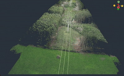
Especializado em linhas de transmissão
e faixa de servidão
The drone flies over, takes photos and IRT3D solves it for you .
-
Relatório automático de poda.
-
Identificação automática de áreas de risco.
-
Projeção de queda de árvores.
-
Auditoria de poda e supressão.
-
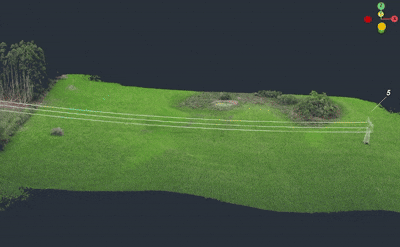
Ferramentas de medição de área.
-
Cálculo de volume de poda.
-
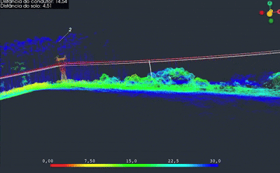
Cálculo de distância entre vegetação e condutor.
-
Customização de parâmetros.

Monitor
Monitor
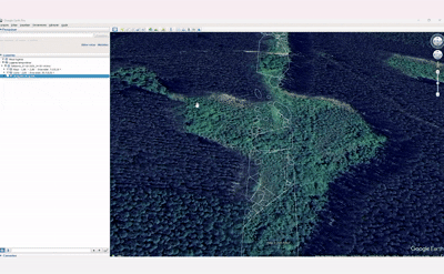
Increase your productivity through monitoring using a drone. Optimize your projects by spending less time in the field.
Measure
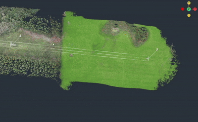
Our system offers several high-precision tools for detailed measurements. With it you can easily measure distance, area, volume, among many other tools.
Whether environmental, structural, electrical or even security, with our system, it is possible to develop projects with greater efficiency and speed.
Plan
Whether environmental, structural, electrical or even security, with our system, it is possible to develop projects with greater efficiency and speed.
Plan
Whether environmental, structural, electrical or even security, with our system, it is possible to develop projects with greater efficiency and speed.
Whether environmental, structural, electrical or even security, with our system, it is possible to develop projects with greater efficiency and speed.
Plan
Whether environmental, structural, electrical or even security, with our system, it is possible to develop projects with greater efficiency and speed.
Plan
Nossas ferramentas de medição eliminam a necessidade de ferramentas manuais e exposições ao risco em campo.
Distâncias em 3D: Calcule vãos e distâncias com decomposição em eixos (X, Y, Z).
Mapeamento de Áreas: Definição de áreas de interesse pelo usuário para extração automática de área (m²) e perímetro (m).
Gestão de volume: Cálculo preciso de volumes para gestão de ativos, como pilhas de material, terra ou minérios.
The drone flies over, takes photos and IRT3D solves it for you .

Monitor
Sem a necessidade de sensores LiDAR, a tecnologia utiliza inteligência avançada para garantir precisão, eficiência e redução significativa de custos, tornando o monitoramento aéreo mais acessível, escalável e fácil de implementar em diferentes operações.


